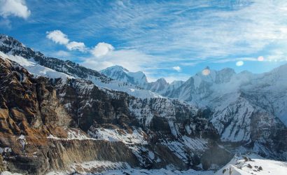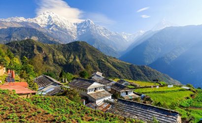
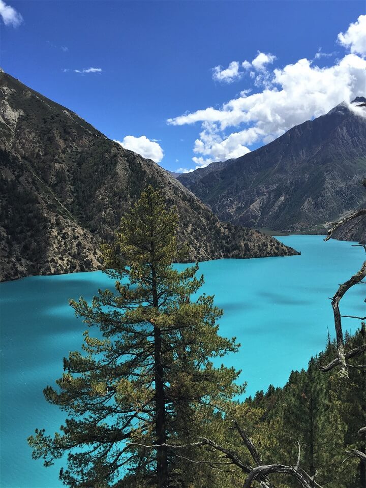
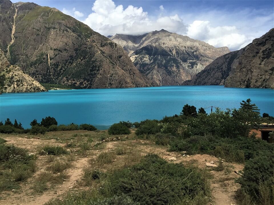
The Upper Dolpo camping trek takes you to a rugged and remote region in the far west of Nepal. This beautiful Dolpo area borders Tibet. Because of this, the culture is strongly influenced by Tibetan Buddhism and a large part of the landscape looks Tibetan. In the west of the region is also the Shey Phoksumdo National Park, with the beautiful turquoise blue Phoksumdo lake.
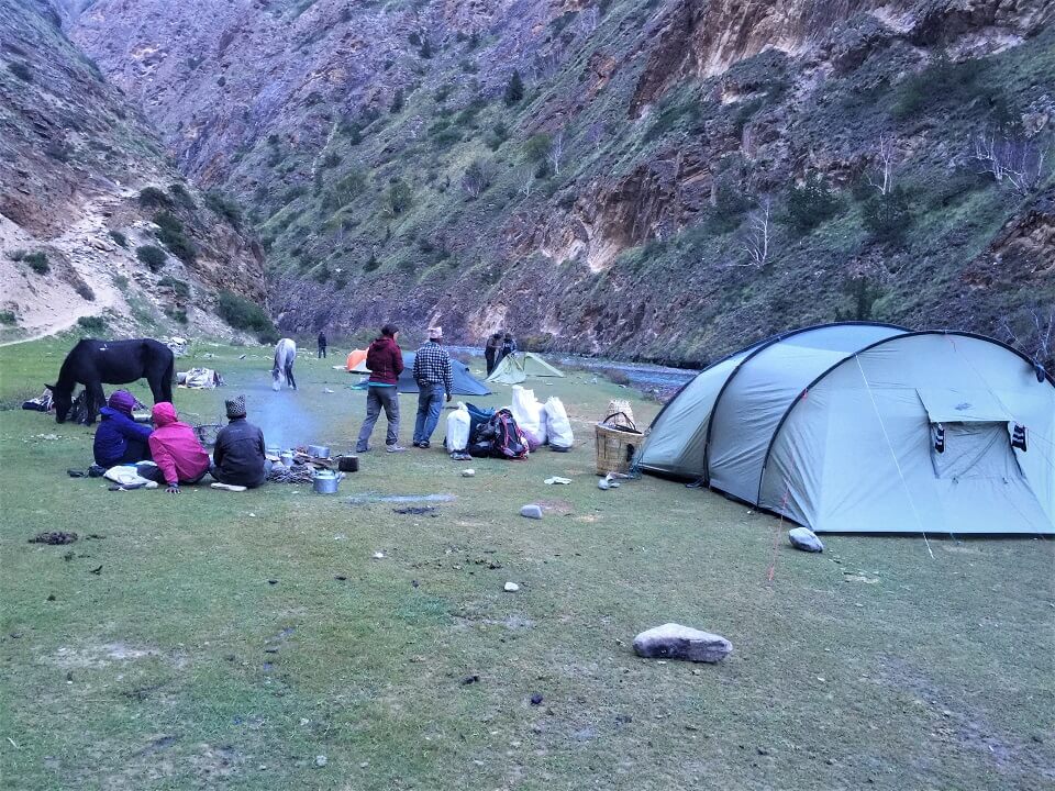
Because this area is remote, underdeveloped and poor, it is necessary to camp and bring your own food. You will spend the night on nice camping spots, with a view of the mountains and sometimes near a river. The Nepalese team that is with you makes a different menu every day. If local products are to be found along the way, the cook will buy them and process them into a delicious dish.
In this region you are not allowed to go on the road without a Nepalese guide, you are obliged to go with a minimum of 2 hikers and you need a special permission from the government.
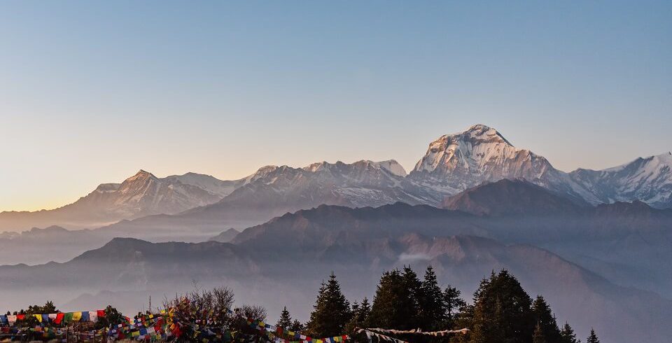
Hiking in the Upper Dolpo is a unique experience. You will hike through deep valleys, along high passes and peaks, enjoy the turquoise blue Phoksumdo lake and visit the ancient Shey Gomba. Then we forget the chance to see some rare wildlife – including the elusive snow leopard – and get acquainted with the lifestyle of the local nomadic people.
————————————-
Would you like to customize your Nepal trip?
Let yourself be inspired by this trip. You can adjust the trip to your individual preferences and wishes.
Overview
- Trek with a Nepalese team through a remote, untouched part of Nepal
- Watch out for traces of the hideous snow leopard in Shey Poksumdo National Park
- Visit the 800 year old monastery in Shey Gompa and the Heritage in Tsakang
- Dream away from the azure blue Phoksumdo lake
.
Itinerary
Namaste and welcome to Nepal.
Today, you take a flight to Nepalgunj. Because the flights to Juphal only fly early in the morning, you spend the night here.
Overnight stay in a teahouse/simple hotel in Nepalgunj.
Early in the morning you take a second flight that takes you even more into the mountains to Juphal.
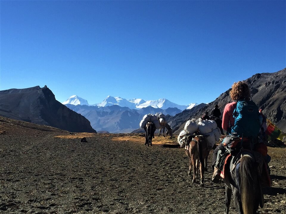
After arrival it's a while until the guide has arranged everything so you can go with a team and enough food with the tents into the mountains. Once the Nepalese team is ready to leave and the luggage is loaded, you will leave for Dunai.
It is a short walking day today: between terrace fields you will walk for about 3 hours until you arrive in Dunai.
You will spend the night in a double tent.
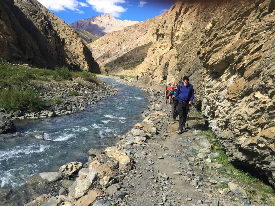
From the center of Dunai you descend to a suspension bridge and cross the Thuli Bheri Khola. You then walk upstream on the path. The path along the river goes up and down several times. At the end of this path, you arrive in Sulighat (2282m).
From this village you follow the path on the other side of the river until you reach Raktang (2421m), where you cross the river again. Another hour further you cross the river again in Shyanta, a winter residence for the people of Ringmo. After crossing a side arm of the river, the path continues up to Chhepka (2720m).
You will spend the night in a double tent in Chhepka.
You're walking through an old-growth forest today. Afterwards you cross the Suli Khola again an hour later. The path continues through a dense forest.
After crossing a side arm of the river, the path rises steeply for about 380 meters until you reach a wide grass plateau. The flat path on the plateau only takes a while, because soon you descend again to the river.
You walk further to Sanduwa (2960m). Before you arrive in Sanduwa, cross the river again near the Tapriza Secondary School and the Gompa.
If you like you can visit the school and make a small donation. From the school you walk further along the banks of Phoksumdo Khola river.
After about twenty minutes you reach the camp site in Jharina Hotel (3020m).
You will spend the night in a double tent in Jharina Hotel.
The path climbs slightly on the bank of the Phoksumdo Khola, and rises further through a cedar and pine forest. It is a long climb that passes by another winter residence, Polam (3400m), where permits are checked again.
You keep climbing on a winding and steep path up to a mountain ridge, where you can enjoy a magnificent view of the turquoise and cobalt blue lake of Phoksumdo and a gigantic waterfall (3800m).
The path now continues downhill through a birch forest to the clear source of the waterfall. Afterwards you climb again slightly up to Ringmo (3640m).
You spend the night in a double tent in Ringmo.
Today the guide will take you on a walk around the beautiful lake. Lake Phoksumdo is a protected nature reserve and it is Nepal's deepest and second largest lake.
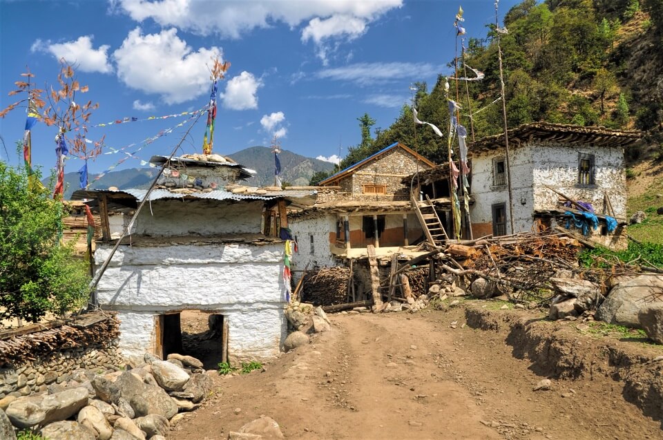
Ringmo is a traditional Tibetan village, situated on the southern shore of the lake. The local people make various craft products there.
About 1.5 km from Ringmo, on the southeast shore of the lake is Pal Sentan Thason Chholing Gompa, of the Bon religion. This religion is quite similar to Tibetan Buddhism, with the only difference being the practical performance of a number of rituals that are performed in reverse. For example, at the Bons you pass a mani wall or chorten along the left side and when you walk around or in a gompa, you walk in the opposite direction. In Tibetan Buddhism you leave a mani wall or chorten on your right side and when you walk around or in a gompa, you walk clockwise.
You spend the night in a double tent in Ringmo.
Time for one of the most spectacular parts of the trekking! Along the west side of the lake you walk to the steep cliffs, which you then cross via a steep path. The path doesn't rise that much in the first half hour, but you have a beautiful view of the village and the lake.
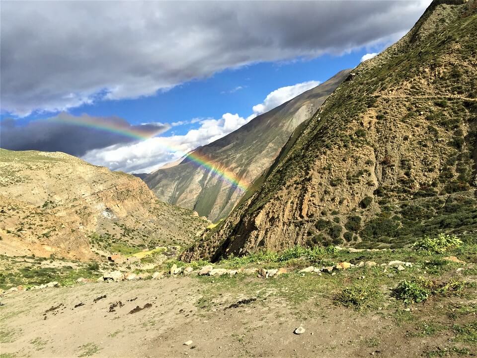
After crossing a small stream, the path climbs steeply up to 4140 meters. Keep your fingers crossed that you won't encounter a caravan of yaks here!
Then the path descends to the flood area of the Phoksumdo Khola at the northern part of the lake (3630m). After half an hour you cross the river and walk into a pine forest that later turns into a silver birch forest. Did you know that the bark of the silver birch is often used by Tibetans to write down prayers, which they then leave on the mountain passes or at important chortens?
You cross the river several times on large stepping stones and then climb up to the valley. Afterwards the valley narrows again into a gorge and you walk along the river again. You soon arrive at the camping site.
You spend the night in a double tent in Phoksumdo Khola Camp.
From your camp site it's only a few minutes to the beginning of the gorge. The path goes uphill into the gorge, crossing the river several times.
The sound of the river in the gorge makes all conversation here impossible, so staying together is the message. The guide keeps an extra eye that everyone follows.
The slope of the path decreases as the gorge widens. You walk on until you reach a small valley. At the end of this valley there is a nice little waterfall that left a gully (4717m). You ascend further along a zigzagging path next to the waterfall. After about 100 meters the path becomes less steep.
You ascend further to the higher parts of the valley, which gradually widen to a large basin (4810m). You camp in this basin.
You spend the night in a double tent in Pass Camp.
On the ridge above the basin lies the Nangdala La pass, which we cross today. The path to it is a pass with loose slates and rises inexorably for 2,5 hours.
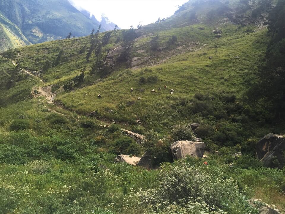
Once at the top of the Nangdala La pass (5350m) you'll see a wide valley that descends to a stream, which you'll reach in an hour after crossing the pass. The path now slowly descends further into the valley, crossing the stream several times. In this valley a lot of yaks and sheep graze.
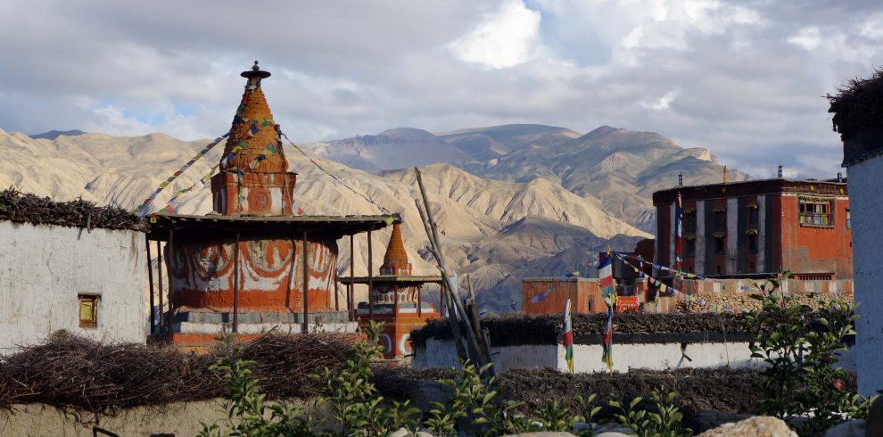
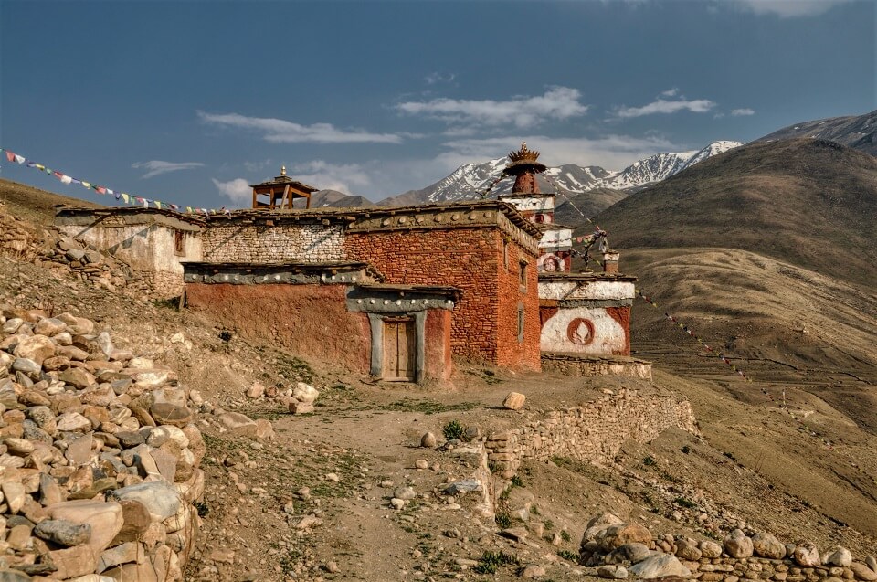
An hour and a half later you reach the red walls of the Shey Gompa (4343m), surrounded by mani walls and chortens and situated in a green meadow.
You spend the night in a tent camp in Shey Gompa.
Located on the cliffs about an hour north of Shey Gompa, is the Hermitage of Tsakang. In the past the Lama of Shey lived here, but the present incarnation of this Lama lives in Kathmandu. If you can find the key keeper here, it's worth visiting the frescoes inside.
Here you can not only visit the hermitage but also the Gompa of the Kagyupa sect. There are many legends about the founder of the Shey Gompa and Tsakang. Tsan-zin Ra Ra lived in the early 17th century and made Dolpo one of the holiest valleys in Nepal. The locals insist that no animal is killed in and around Shey Gompa. This may explain why you have a greater chance of seeing blue sheep and the snow leopard in this valley.
You spend the night in a tent camp in Shey.
Heading east from the Gompa you walk into the arid Sephu Khola valley, following the path along the river. At a certain point you enter a side valley and climb for 2.5 hours on a path with loose ground up to the Sela La mountain pass (5095m).
After the pass you descend into a narrow valley and continue walking to the small village of Namgung (4360m).
You will spend the night in a double tent in Namgung.
Today is a short walking day, which is nice too!
At the end of the valley you climb over the ridge, which forms the bank of the Nagon Khola river.
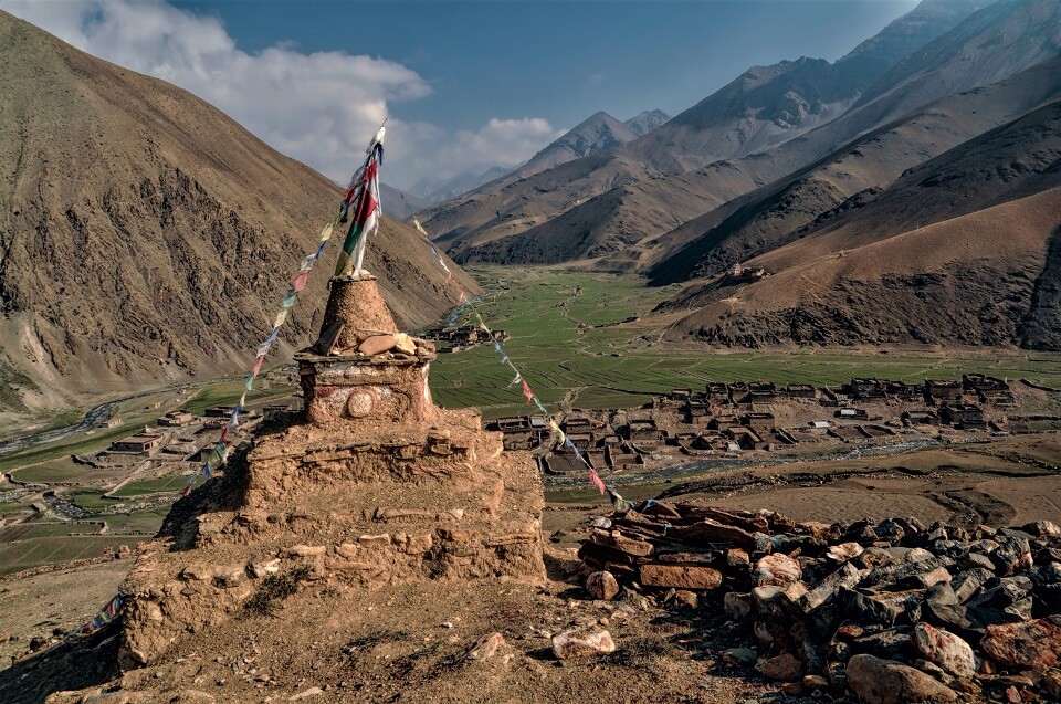
Then you walk in a northwesterly direction along the Nagon Khola River to the administrative center of Upper Dolpo, Saldang (3770m).
You will spend the night in a double tent in Saldang.
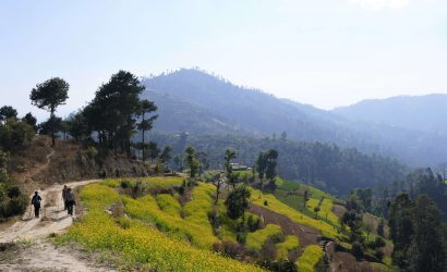
The Nagon Khola valley has gently sloping slopes over which an easily undulating path runs. Branches merge into one another and offer you a beautiful view of daily life in this area.
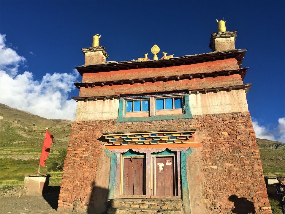
A quiet 3 hour walk from Saldang is Chagaon (3840m), where you can visit a small Gompa next to the river. On the ridge above the village there is another hermit gompa, which is very popular with local and Tibetan lamas.
You will spend the night in a double tent in Chagaon.
The further south you walk, the steeper the valley walls become and the more ferocious the terrain becomes. A crumbling fortress stands above the river behind the last village, Chasip. The path rises slowly along the river.
After an hour and a half walking you cross the river and you also see some stone houses in Rakyo Kharka. It is possible that you will have to walk through the water here, in case the river has damaged the path.
Two hours later you arrive at a large side stream of the river, which has its own valley. You walk into this Dachung Khola valley. After another two hours walk the river splits up again. You cross the Dachung Khola river and follow again the path that runs in the side valley.
You walk in this valley with steep walls until you reach a flat lawn. This is where we pitch the tents.
You spend the night in a double tent in Dharsuma Dhoban.
You start with a gradual climb of about 500 meters to the Jyanta La pass (5220m).
After crossing the pass you descend into a large narrow mountain valley. At the end it is swampy, on the banks of the Jyanta Khola river. You descend slowly along the river until after an hour and a half you come across a wall with loose gravel. Once you pass this wall you descend less steep and cross the river.
While the valley slowly widens, you pass several mani walls and chörtens. A last descent brings you to the camping site near the village Tokyu (4209m).
You spend the night in a double tent in Tokyu.
In the wide, fertile Thakchu valley there are several Magar and Bhotia villages; they are close to each other and almost run into each other. These permanent settlements are of the highest in the world, situated at an altitude of 4100 meters. The green valley is therefore very popular with Tibetan nomads to graze their cattle.
There are both Buddhist and Bon Gompas in this valley, although they are not as old as those in Upper Dolpo.
The trail leads from Tokyo through this valley and is a pleasant walk past villagers who are busy with their daily tasks. Dho Tarap is the last village in this valley and from there you descend to the narrower Tarap Khola valley where you continue your hike to Ghyamghar.
You will spend the night in a tent camp in Ghyamghar.
The valley becomes a gorge with a wild river, which you cross over a bridge. You descend slowly to a junction with a tributary. You follow the path until you reach Chhyugar (3440m).
The path is carved out of the rocks and now descends more steeply. The last part is a winding, steep path up to the beautiful waterfall in Laina Odar (3770m).
The path descends all the time and suddenly the Tarap Khola valley becomes the Thuli Bheri Khola valley. A little further on is the camping site in Laisicap (2775m).
You spend the night in a tent camp in Laisicap.
After days of descending and ascending on narrow and adventurous paths, it is a relief to walk on a larger road along the Thuli Bheri River today. Today you walk about 5 hours.
There is little shade on this part, so sunscreen and plenty of water are a must.
About an hour walk from Laisicap, you'll arrive at the establishment of Tarakot (2540m), a popular wintering place for the people of Do Tharap.
After the village you walk along the other bank of the river until you reach Dunai (2140m). Just before Dunai you cross the river again.
You spend the night in a teahouse in Dunai.
Today you get up early and walk to Juphal, the end point of your trekking.
In Juphal you say goodbye to the local kitchen team and the person responsible for the donkeys and/or the porters.
Here you take a domestic flight to Nepalgunj and then a second flight to Kathmandu.
The rest of the day is free to spend in Kathmandu.